EARTH CHANGES ARCHIVE
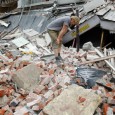
Earthquake catastrophes and fatalities projected to rise with population growth in this century- Posted on February 22, 2013 | 1 Comment“Predicted population increases in this century can be expected to translate into more people dying from earthquakes. There will be more individual earthquakes with very large death tolls as well as more people dying during earthquakes than ever before“, according to a new study led by U.S. Geological Survey engineering geologist Thomas L. Holzer. Four catastrophic earthquakes have already struck since the beginning of the 21st century. M 9.1 earthquake that hit Sumatra/Andaman region on December 26, 2004 was the third largest earthquake in the world since 1900 and is the largest since the 1964 Prince William Sound, Alaska earthquake. In total, 227,898 people...
Mt. Etna is waking up – new eruption produced lava fountains and lava flows
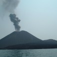
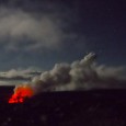
Posted on February 20, 2013 | No CommentsIn the first true paroxysm at Mt.Etna in Italy, after nine months, volcano gave birth to new lava fountains and lava flows from the New SE crater. The strombolian activity rapidly increased and merged into lava fountains on February 19, 2013. INGV Sezione di Catania reported a lava flow reached about 2600 m elevation on the slope north of Sierra Giannicola Picola and descended into Valle del Bove. A strong phase of strombolian activity took place over night on February 17, 2013 at the New SE crater. The strong strombolian activity started on February 18, 2013 and progressively increased and merged into lava fountains by February...Strong earthquake M 6.1 struck New Zealand
Posted on February 18, 2013 | No CommentsStrong earthquake M 6.1 struck Kermadec Islands, New Zealand on February 18, 2013 at 12:19:19 UTC. Epicenter was located 161 km (100 miles) S (189°) from Raoul Island and 1099 km (683 miles) SSW (195°) from NUKU’ALOFA, at co-ordinates 30.682°S, 178.127°W. Depth of the earthquake was recorded at 34.1 km. EMSC reported same magnitude at depth of 10 km and co-ordinates 30.63 S ; 178.20 W. GDACS reports this earthquake can have a low humanitarian impact based on the Magnitude and the affected population and their vulnerability. There’s no population within 100 km radius. Magnitude 6.1 Date-Time Monday, February 18, 2013 at 12:19:19 UTC Location 30.682°S,...Strong earthquake M 6.0 strikes off east coast of the North island, New Zealand
Posted on February 16, 2013 | No CommentsAfter 40 minutes of Philipines earthquake today, strong but luckily deep earthquake with recorded magnitude 6.0 hit off east coast of the North island, New Zealand on February 16, 2013 at 05:16 UTC. Epicenter of the earthquake was located 219 km (136 miles) ENE of Tairua, New Zealand and 223 km (138 miles) NNE of Whakatane, New Zealand at coordinates 36.130°S, 178.045°E, as per USGS data. Depth was measured at 204.5 km (127.1 miles) by USGS. EMSC reported same magnitude at coordinates 36.41 S ; 178.18 E and at depth 169 km. This report is based on preliminary data supplied by USGS and EMSC. GDACS reports this earthquake can have...Strong M 6.2 earthquake struck Mindanao, Philippines
Posted on February 16, 2013 | 1 CommentStrong earthquake magnitude 6.2 struck Mindanao, Philippines on February 16, 2013 at 04:37 UTC. USGS reported epicenter of earthquake 28 km (17 miles) SE of Caburan and 65 km (40 miles) ESE of Malapatan at coordinates 5.759°N, 125.838°E. Depth of the earthquake was recorded at 98.2 km (61 miles). EMSC reported same magnitude at depth of 113 km and co-ordinates 5.80 N ; 125.89 E. This report is based on preliminary data supplied by USGS and EMSC. GDACS reports this earthquake can have a low humanitarian impact based on the Magnitude and the affected population and their vulnerability. 1290000 people live within 100km radius of the earthquake. Magnitude...Very strong earthquake magnitude 6.6 struck northeastern Sakha, Russia
Posted on February 14, 2013 | No CommentsVery strong and shallow earthquake magnitude 6.6 struck northeastern Sakha region of Russia on February 14, 2013 at 13:13 UTC. Epicenter of the earthquake was located 132 km WSW of Druzhina and 862 km NE of Markha at co-ordinates 67.613°N, 142.601°E, as per USGS report. Depth of the earthquake was 9.9 km. EMSC reported same magnitude at depth of 10 km and co-ordinates 67.65 N ; 142.55 E. This report is based on preliminary data supplied by USGS and EMSC. GDACS reported that this earthquake can have a low humanitarian impact based on the Magnitude and the affected population and their vulnerability. There are about...Active volcanoes in the world: February 6 – February 12, 2013
Posted on February 14, 2013 | 1 CommentThis week, 9 volcanoes were noticed to have new activity, whereas ongoing activity was reported for 13 volcanoes. This report covers active volcanoes in the world recorded from February 6 – February 12, 2013 based on Smithsonian/USGS criteria. New activity/unrest: | Aoba, Vanuatu (SW Pacific) | Cleveland, Chuginadak Island | Etna, Sicily (Italy) | Rabaul, New Britain | Rasshua, Kuril Islands (Russia) | Reventador, Ecuador | Soufrière Hills, Montserrat | Stromboli, Aeolian Islands (Italy) | White Island, New Zealand Ongoing activity: | Bagana, Bougainville | Batu Tara, Komba Island (Indonesia) | Bezymianny, Central Kamchatka (Russia) | Chirpoi, Kuril Islands (Russia) | Karymsky, Eastern Kamchatka (Russia) |...Dimishing Arctic sea ice – CryoSat reveals facts about ice volumes
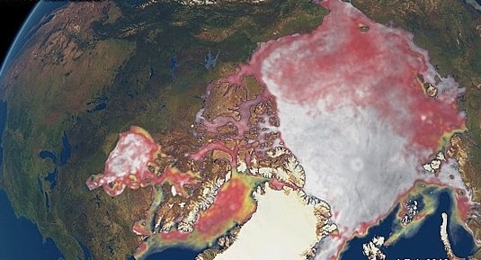
Posted on February 13, 2013 | 1 CommentAn international team of scientists led by University College London provided insight into decline of Arctic sea ice volume and generated estimates of the sea-ice volume for the 2010–11 and 2011–12 winters over the Arctic basin using data from ESA’s CryoSat satellite. According to the study, volume of Arctic sea ice had reduced by 36% during autumn and 9% during winter between 2003 and 2012. For the first time, it has been validated that volume of sea ice and its extent in polar region has declined substantially in tandem. Notably, there has been a constant downward trend in Arctic sea ice...New eruption of Paluweh volcano
Posted on February 13, 2013 | No CommentsThe number of small tremors and emissions of ash at Paluweh (also known as Rokatenda) volcano increased in October 2012, and continued into February 2013, probably indicating growth of the lava dome. After months of rumbling, an explosive eruption occurred on February 2 and 3, 2013. Satellite images show the path of a volcanic landslide, likely the remnants of a pyroclastic flow. A brand-new delta extends into the Flores Sea at the foot of the flow. Gray ash from the eruption covers the southern slopes of the peak. According to the Darwin Volcanic Ash Advisory Center (VAAC), Paluweh has experience minor ash and gas emissions almost daily since the...Daily satellite data about the condition of the Greenland ice sheet
Posted on February 10, 2013 | No CommentsThe National Snow and Ice Data Center (NSIDC) launched a new website called Greenland Ice Sheet Today which provides daily satellite data about the condition of the Greenland ice sheet. The website also provides analysis, when possible, and will serve not only scientists but interested members of the general public. Greenland’s surface melting in 2012 was intense, far in excess of any earlier year in the satellite record since 1979. In July 2012, a very unusual weather event occurred. For a few days, 97% of the entire ice sheet indicated surface melting. This event prompted NSIDC to build this Web site,...Great Lakes water levels reached record lows
Posted on February 10, 2013 | 1 CommentThe U.S. Army Corps of Engineers measured record low water levels in two of the North America’s Great Lakes, Michigan and Huron. The water levels at Lake Michigan and Lake Huron reached the lowest level from 1918, since modern record-keeping began. Water levels at Lake Michigan and Lake Huron broken records the past two months, and the levels have been very near record lows for the last several months. Lake Michigan-Huron’s water levels have also been below average for the past 14 years, which is the longest period of sustained below-average levels since 1918. According to hydrologists, the relatively warm and...Very strong M 6.9 earthquake struck Columbia
Posted on February 9, 2013 | No CommentsVery strong earthquake with recorded magnitude 7.0 struck Columbia on Saturday, February 09, 2013 at 14:16 UTC. Epicenter of the earthquake was located 5km (3mi) NE of Yacuanquer and 11 km (7 miles) SW (235°) from Pasto, co-ordinates were 1.143°N, 77.362°W. Recorded depth was 129.3 km (80.3 miles) according to USGS. EMSC has reported magnitude of 7.0 at depth of 136 km. These observations are based on preliminary data. GDACS reports that this earthquake can have a low humanitarian impact based on the magnitude and the affected population and their vulnerability. There are 1 690 000 people living within 100 km. Update: USGS updated magnitude of the earthquake to 6.9 and...Winter storm “Nemo” progress in the Eastern US
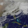
Posted on February 9, 2013 | No CommentsThe second and most powerful “nor’easter” of the season, aims New England and states in the region are preparing for the worst. The western frontal system stretching from Canada through the Ohio and Tennessee valleys and down into the Gulf of Mexico is expected to bring high winds and up to 2–3 feet of snowfall across much of New England. The convergence of two massive low-pressure systems is forecast to create a powerful nor’easter, which The Weather Channel has dubbed “Nemo.” Watch as two low-pressure systems converge to bring a storm with record snowfall amounts to the US northeast on February 8, 2013. Know the dangers...“CHASING ICE” captures largest glacier calving ever filmed
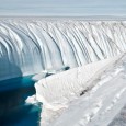
Posted on February 8, 2013 | 2 CommentsIn this case a mass movement of ice, not rock and soil, on the Ilulissat Glacier in Western Greenland, a part of the film Chasing Ice. It is genuinely astonishing – the volume of the collapse is apparently 7.4 cubic kilometres. On May 28, 2008, Adam LeWinter and Director Jeff Orlowski filmed a historic breakup at the Ilulissat Glacier in Western Greenland. The calving event lasted for 75 minutes and the glacier retreated a full mile across a calving face three miles wide. The height of the ice is about 3,000 feet, 300-400 feet above water and the rest below water....Active volcanoes in the world: January 30 – February 5, 2013
Posted on February 7, 2013 | 2 CommentsThis week, 6 volcanoes were noticed to have new activity, whereas ongoing activity was reported for 11 volcanoes. This report covers active volcanoes in the world recorded from January 30 – February 5, 2013 based on Smithsonian/USGS criteria. New activity/unrest: | Colima, México | Etna, Sicily (Italy) | Paluweh, Lesser Sunda Islands (Indonesia) |Rabaul, New Britain | Reventador, Ecuador | White Island, New Zealand Ongoing activity: | Batu Tara, Komba Island (Indonesia) | Chirpoi, Kuril Islands (Russia) | Copahue, Central Chile-Argentina border | Karymsky, Eastern Kamchatka (Russia) | Kilauea, Hawaii (USA) |Kizimen, Eastern Kamchatka (Russia) | Lokon-Empung, Sulawesi | Sakura-jima, Kyushu | Santa María, Guatemala | Shiveluch, Central Kamchatka (Russia) | Tolbachik, Central Kamchatka (Russia) The Weekly Volcanic Activity Report is...Recent major earthquakes show underestimated potential for ‘Superquakes’
Posted on February 7, 2013 | 5 CommentsRecent destructive M 8.0 earthquake that struck Solomon Islands on February 6, 2013, as well as ongoing seismic swarm in the area, is fair reminder that we live in a planet that is undergoing constant change. According to seismologist’s theories of earthquake cycles. the devastating earthquakes that rocked Tohoku, Japan in 2011, Sumatra in 2004 and Chile in 1960 — all of magnitude 9.0 or greater — should not have happened. And that might mean earthquake prediction needs an overhaul, some researchers say. All those earthquakes, including the latest at Santa Cruz Islands, struck along subduction zones, where two of Earth’s tectonic...Cleveland volcano in Aleutian Islands woke up – A new dome has formed in the summit crater
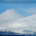
Posted on February 7, 2013 | No CommentsElevated surface temperatures were detected in satellite images of Cleveland volcano over the last 24 hours. The aviation color code and volcano alert level were changed to ORANGE/WATCH based on evidence that a new dome has formed in the summit crater of Cleveland. The dome is about 100 m in diameter and presumably formed starting January 24, 2013 when elevated surface temperatures were observed in satellite images. The development of a lava dome in the summit crater indicates that sudden explosions of blocks and ash are possible with little or no warning. Ash clouds, if produced, could exceed 20,000 feet...Snowiest winter in 100 years paralyzes Moscow
Posted on February 6, 2013 | No CommentsThe snowiest winter in a century has hit Moscow, Russian capital, causing traffic jams 3,500 km in length on Monday evening, February 4, 2013. This is equal to the distance from Moscow to Madrid and snowfall is expected for four or five more days. Moscow has not witnessed such a snowy winter in the past 100 years, Deputy Mayor Pyotr Biryukov said on Tuesday. “This is the snowiest winter in 100 years,” Biryukov said, adding that 216 centimeters (85 inches) of snow have blanketed Moscow since the beginning of winter, which is 1.5 times above climatic norm. The snowfall also caused...Massive and deadly M 8.0 earthquake hit Santa Cruz Islands – Tsunami went 500 m inland damaging 3 villages
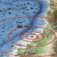
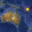
Posted on February 6, 2013 | 2 CommentsMassive and deadly subduction earthquake, registered as M 8.0 (USGS/EMSC), hit Santa Cruz Islands at 01:12 UTC on February 6, 2013. The epicenter was located at coordinates 10.752°S, 165.089°E, about 81 km (50 miles) W of Lata, Solomon Islands at depth of 5.8 km (3.6 miles) (poorly constrained). Depth was later revised to 28.7 km by USGS. EMSC is reporting magnitude 7.9 and depth of 20 km. Numerous extremely strong aftershocks continued days after the 8.0 earthquake. Full list of aftershocks and world earthquakes since February 6 can be found at the end of the article. The image below shows the focal mechanisms of the many...And this is only the beginning?
You need to be a member of Ashtar Command - Spiritual Community to add comments!
Latest Activity
"Drexk- I don't mean to make this post about myself but, people have seen my doppelganger-if you get a chance could you ask your sources if there is a message for me. I've tried getting a telepathic link but no dice-yet.
This is nutty funny!…"
This is nutty funny!…"
"This is even nuttier;
https://www.youtube.com/watch?v=3CmioO6XshA&feature=youtu.be"
https://www.youtube.com/watch?v=3CmioO6XshA&feature=youtu.be"
"Malcolm-a related vid only by the bright light referenced above. I took this vid in January of a bright light in the sky above Princeton NJ. Watch for the entire 2"30 mins. You can see the ship. Drexk says it's a GFL Beam Ship. There are lots of…"
The Universe Flows With Infinite Possibilities For You ! The universe doesn’t judge or keep score — it flows with you. Every choice you make? It’s a step forward. That’s what matters. 🌠 Your thoughts, your decisions, are like quiet conversations…
Powerful Forgiveness Meditation With Reiki Are you ready to let go of the weight you've been carrying? This powerful forgiveness meditation with Reiki healing will guide you through a deep emotional release, helping you free your heart from…



Comments